
For weeks in the spring of 1950, floodwater turned Winnipeg streets into waterways, forced around 100,000 people from their homes and transformed the way the city would deal with the Red River forever.
Winnipeg’s relationship with the Red River has always been complicated. The city’s location at the meeting point of the Red and Assiniboine rivers helped make it a transportation and commercial centre, but it also left much of the city vulnerable to spring flooding. Long before Winnipeg became a modern city, major floods had periodically swept through the Red River Valley.1
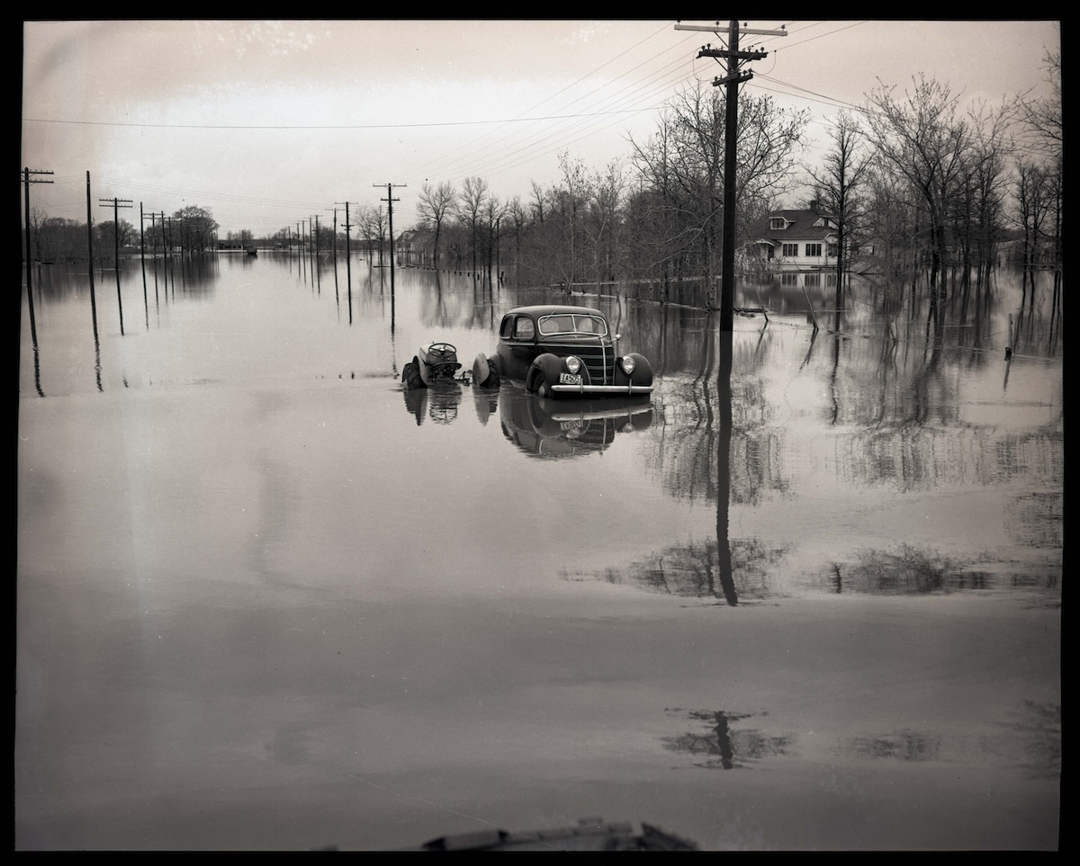
Then came 1950.
What unfolded that spring became one of the most devastating floods in Winnipeg’s history, inundating neighbourhoods across the city and eventually leading to a massive change in how Manitoba protected its capital from the Red River.1
A flood built by snow, rain and a rising river
The 1950 flood began with conditions that had been developing months earlier.
Heavy snow had accumulated during the winter, and spring brought additional rainfall. As the snow melted, the Red River rose rapidly. Manitoba’s records say the river had reached flood levels in Winnipeg by April 22, 1950.1
Heavy rainfall in early May made the situation considerably worse.
The river eventually reached a peak of approximately 9.2 metres, or 30.2 feet, at James Avenue. Water remained above flood stage for 51 days, and in some low-lying areas reached depths of approximately 4.6 metres, or 15 feet.1
This was not Winnipeg’s highest flood ever recorded. Earlier floods, particularly those of 1826 and 1852, had reached even greater heights. But by 1950 Winnipeg was a much larger and more densely populated city, meaning the potential for destruction was vastly greater.3
Winnipeg’s streets became waterways
Historic photographs from the disaster show just how completely the water transformed the city.
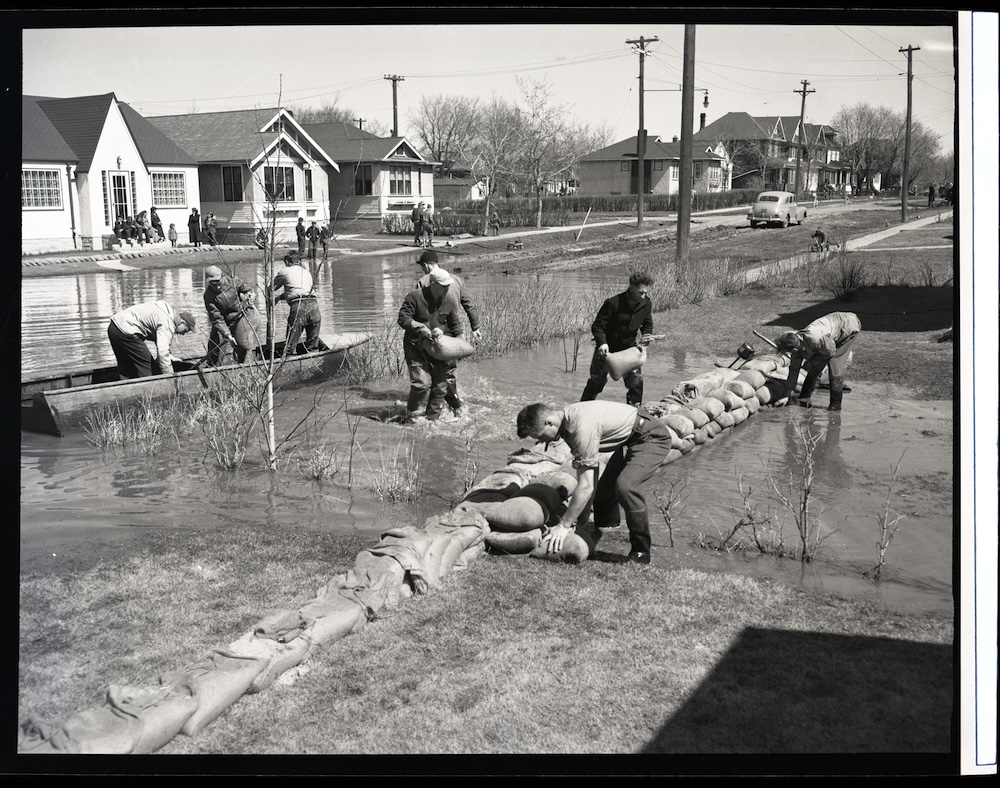
Homes stood surrounded by floodwater. Boats moved through residential streets. Sandbag dikes were constructed around neighbourhoods, while residents, soldiers and volunteers worked to keep the rising river out of homes and important infrastructure.1
One remarkable photograph from the Winnipeg Public Library’s Martin Berman Postcard Collection looks east across Main Street from just south of Broadway.
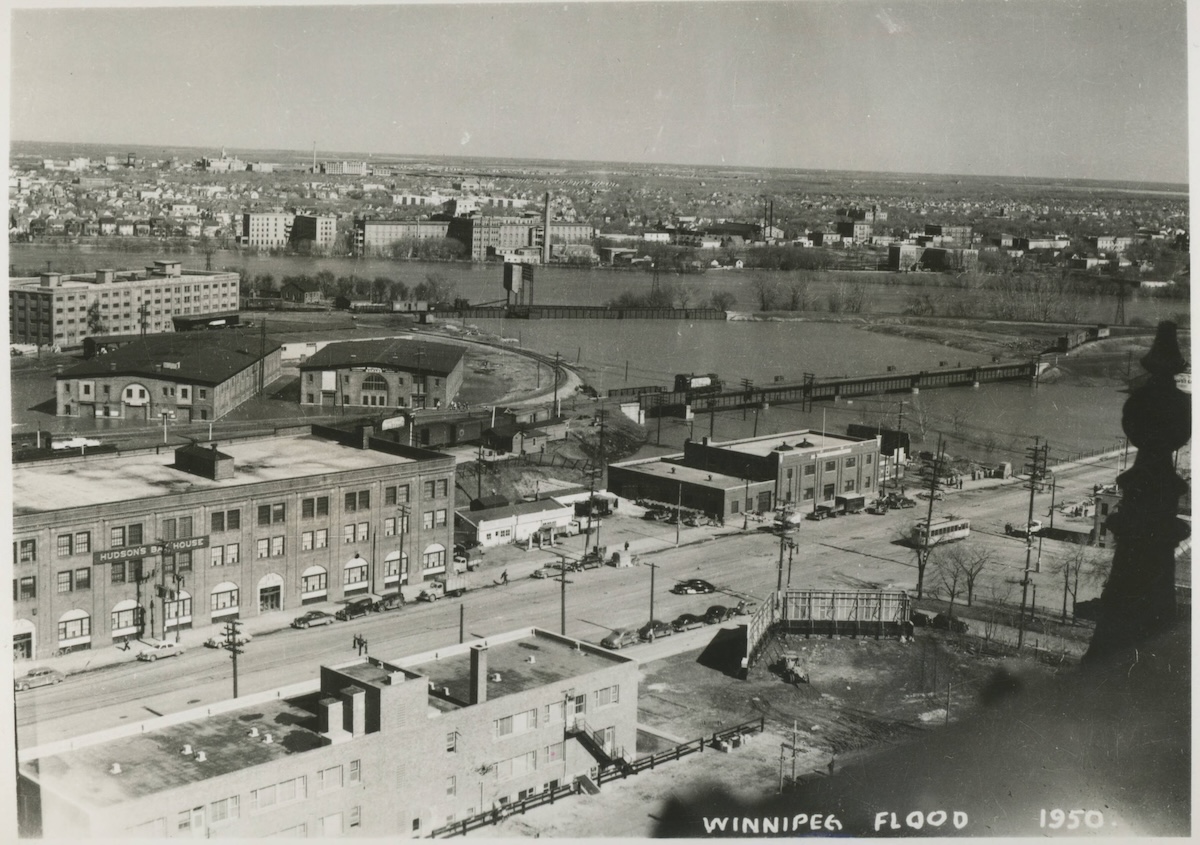
The water stretches across the foreground and surrounding neighbourhoods. The historic Hudson’s Bay House can be seen to the left, while the buildings around the area that would eventually become part of The Forks remain visible in the distance. The photograph also captures railway bridges crossing the flooded landscape and St. Boniface Hospital across the Red River. The archive identifies the photograph as having been taken during the 1950 flood and lists it as public domain.7
It offers an extraordinary glimpse of how different Winnipeg looked when the rivers that helped create the city suddenly became its greatest threat.
100,000 people were forced from their homes
As the water continued to rise, Winnipeg entered a state of emergency.
The Canadian Army and the Red Cross were brought in to help protect property, evacuate residents and organize emergency assistance. Manitoba records estimate that approximately 100,000 people, roughly one-third of Winnipeg’s population, were evacuated during the flood. At the time, that was the largest evacuation in Canadian history.1
The response required an enormous logistical operation.
The City of Winnipeg’s Archives recently digitized nearly 200 photographs showing the relief effort, including images from inside the Winnipeg Auditorium, which became a Red Cross headquarters and evacuation centre. The photographs also show people moving through floodwater and relief supplies arriving from Britain. The City says the photographs were taken by Winnipeg photographer David Portigal.4
Those photographs are fascinating historical records, although the City does not automatically classify its archival photographs as public domain, so individual copyright status should be checked before publication.
The water reached neighbourhoods across Winnipeg
The flood was not confined to one part of the city.
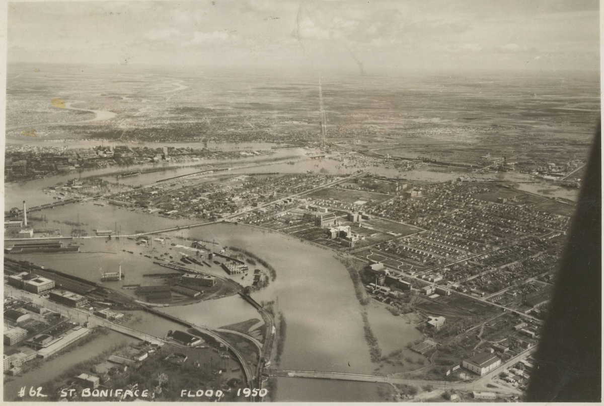
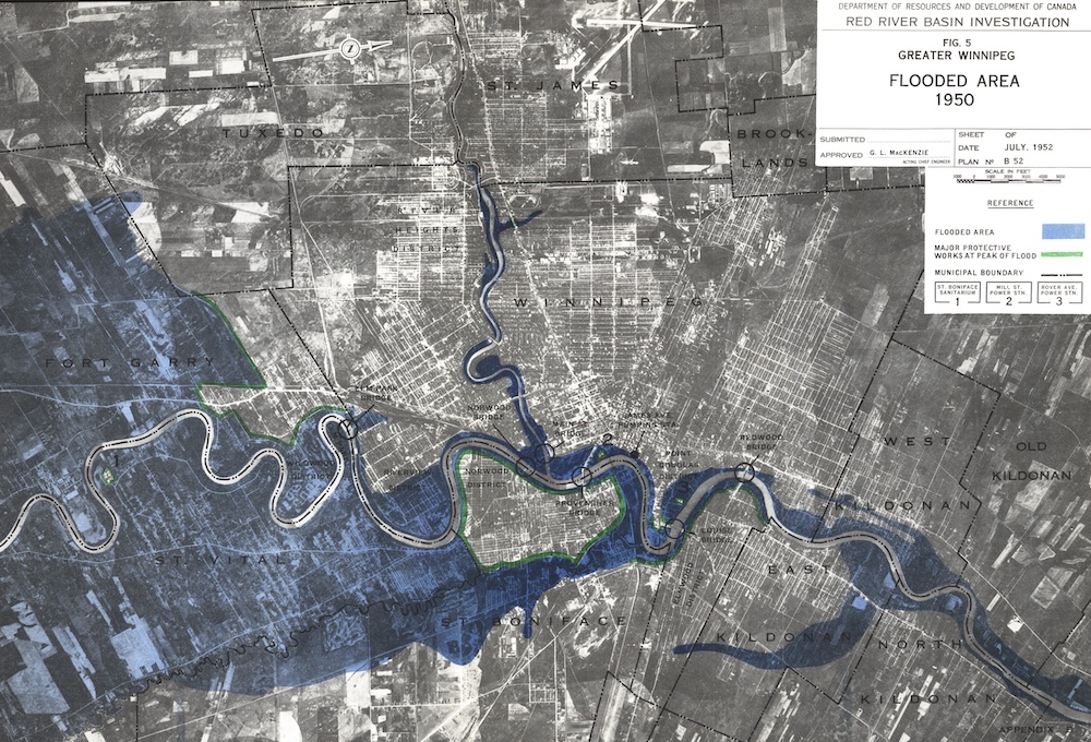
Photographs document flooding in areas including St. Vital, Fort Garry, Fort Rouge and St. Boniface, while the Manitoba government’s historical collection contains aerial and ground-level photographs showing flooded homes, streets and industrial areas.1
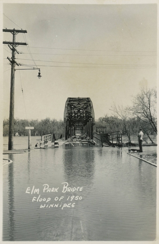
Another public-domain photograph in the Winnipeg Public Library collection shows the Elm Park Bridge during the flood. Water fills the roadway in front of the bridge, with debris pushed onto the structure. The archive places the photograph at the Red River near what is now the familiar Bridge Drive-In area.8
The image is a reminder that the flood was not simply a distant river overflowing its banks. Water was moving through the urban landscape itself.
The cost was enormous
When the water finally receded, Winnipeg was left with massive losses.
The Manitoba government estimates that approximately 10,000 homes were destroyed and another 5,000 buildings were damaged. Total damage was estimated at $125.5 million, equivalent to roughly $1 billion in today’s dollars according to the provincial historical account.1
The flood also demonstrated just how vulnerable the city remained despite decades of engineering work and accumulated knowledge about the Red River.
Winnipeg’s engineers had been recording river levels since the 1870s, and earlier floods had already generated extensive discussion about flood protection. The Manitoba Historical Society’s account, published only a few years after the 1950 flood, examined the city’s earlier floods and the measurements used to understand them.3
The lesson from 1950 was impossible to ignore.
Something much bigger had to be built.
From disaster to “Duff’s Ditch”
One of the greatest legacies of the flood was the construction of the Red River Floodway.
A provincial historical plaque describes the floodway as a direct response to the disaster of 1950. The project was recommended by the Manitoba Royal Commission on Flood Cost-Benefit in 1958 and construction began in 1962 under Premier Duff Roblin. It was completed in 1968.6
The project created a channel running roughly 47 kilometres from St. Norbert to near Lockport, allowing large volumes of Red River water to be diverted around Winnipeg rather than through the city.56
The original project cost approximately $62.7 million and required the movement of an extraordinary amount of earth. Manitoba describes the original excavation as one of the largest earth-moving projects in the world at the time, second only to the Panama Canal.5
The floodway quickly became known as “Duff’s Ditch”, after Roblin, who championed the project.5
Looking back from today’s Winnipeg
Today, it is easy to forget how vulnerable Winnipeg once was.
The Forks is now one of the city’s best-known gathering places. Downtown streets bustle with traffic, buildings and businesses, and most Winnipeggers experience the Red River as part of the city’s landscape rather than as an immediate threat to the entire urban centre.
But the photographs from 1950 tell a very different story.
The same rivers are still there. Main Street is still there. The Forks is still there. St. Boniface and St. Vital are still part of Winnipeg.
What changed was the city’s ability to coexist with the river.
The 1950 flood demonstrated what could happen when an exceptionally heavy spring runoff met Winnipeg’s low-lying landscape and growing population. The Red River Floodway, completed 18 years later, fundamentally changed that relationship. The City of Winnipeg notes that flood peaks in the pre-floodway era were substantially higher than those seen after the floodway was in operation.2
More than seven decades later, the photographs remain among the clearest ways to understand what the disaster actually looked like.
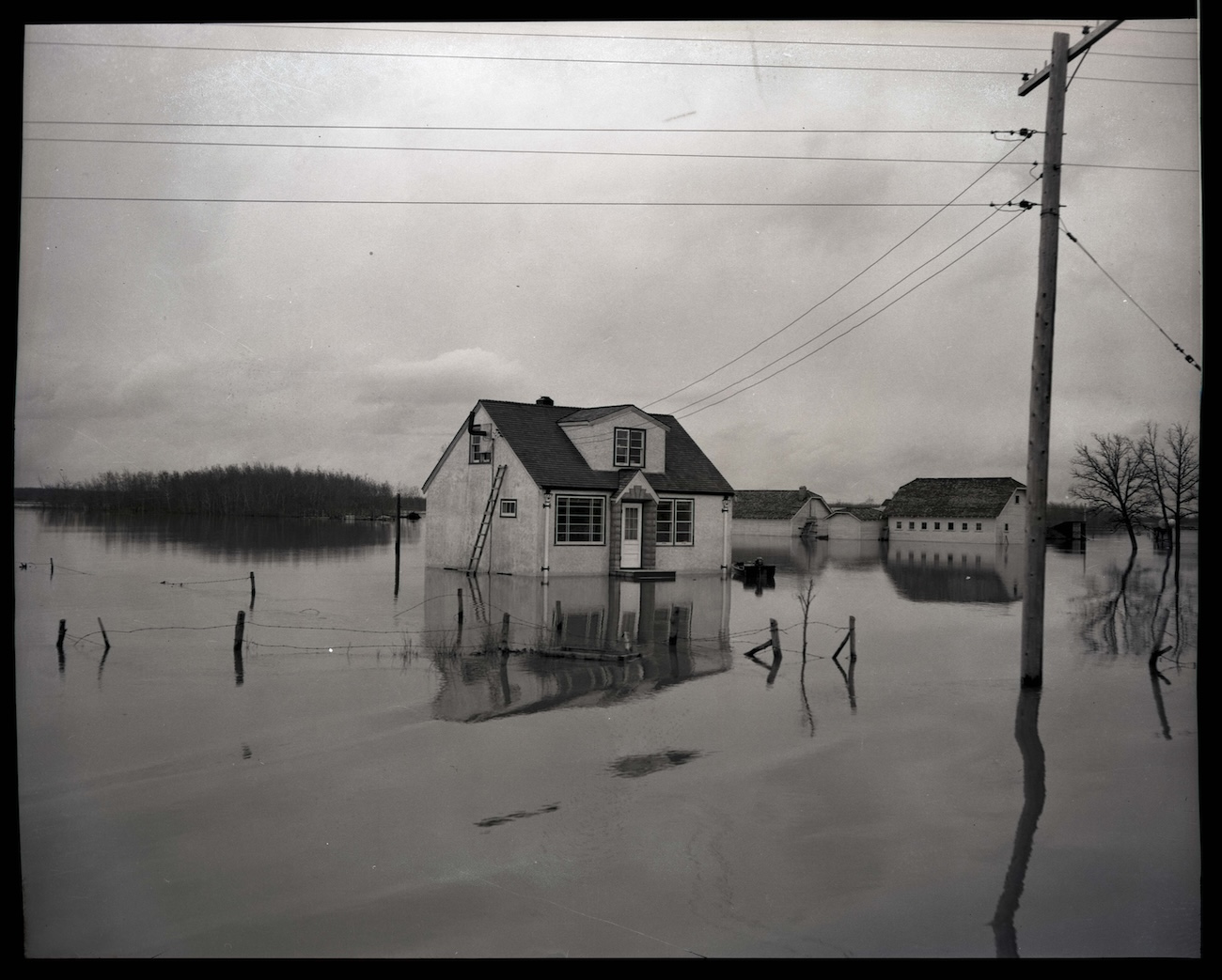
A house surrounded by water. A bridge disappearing into the flood. Boats travelling where cars normally drove.
And a city that would never again look at the Red River quite the same way.
Sources and notes
- Province of Manitoba, “Historic Flood – 1950.”
Provides the key statistics for the disaster, including the timing of the flood, 30.2-foot peak at James Avenue, 51 days above flood stage, evacuation figures, damage estimates and contemporary photographs.https://www.gov.mb.ca/mti/wms/rrf/historical_1950.html
↩ Back to text - City of Winnipeg, “Historical flood information.”
Provides Winnipeg’s recorded flood levels and historical comparison between 1950, 1997 and earlier floods, including the distinction between measurements before and after the Floodway.https://www.winnipeg.ca/services-programs/water-wastewater/flooding/river-flooding/historical-flood-information
↩ Back to text - Manitoba Historical Society, “The Red River Flood of 1950,” William D. Hurst, MHS Transactions, Series 3, 1955–56.
A near-contemporary historical account discussing the 1950 flood alongside earlier Red River floods, historical water levels, flood geography and the development of Winnipeg’s flood knowledge.https://www.mhs.mb.ca/docs/transactions/3/flood1950.shtml
↩ Back to text - City of Winnipeg, “Newly digitized photos provide glimpse of 1950 flood relief effort.”
Describes nearly 200 newly digitized photographs from the 1950 relief effort, including Red Cross operations and evacuation centres, and identifies photographer David Portigal.https://www.winnipeg.ca/people-culture/our-city-our-stories/newly-digitized-photos-provide-glimpse-1950-flood-relief-effort
↩ Back to text - Province of Manitoba, “Red River Floodway.”
Provides the history of the Floodway, including its construction from 1962 to 1968, its cost, capacity and the connection to Duff Roblin.https://www.gov.mb.ca/mti/wms/rrf/index.html
↩ Back to text - Manitoba Heritage Council, “Red River Floodway.”
Describes the Floodway as a response to the 1950 disaster, its 1958 royal commission origins, 1962–1968 construction period and 47-kilometre route.https://www.gov.mb.ca/chc/hrb/plaques/plaq1537.html
↩ Back to text - Winnipeg Public Library, Martin Berman Postcard Collection, “Winnipeg Flood 1950.”
Public-domain photograph showing a bird’s-eye view over Main Street and the flooded Forks area.https://pastforward.winnipeg.ca/digital/collection/berman/id/5074/
↩ Back to text - Winnipeg Public Library, Martin Berman Postcard Collection, “Elm Park Bridge, Flood of 1950, Winnipeg.”
Public-domain photograph showing the flooded Elm Park Bridge and surrounding Red River flooding.https://pastforward.winnipeg.ca/digital/collection/berman/id/5038/
↩ Back to text